| KITHIRA |
 |
 |
This description provides information of ancient sites, seaside resorts, churches, monasteries, landscapes and small towns and villages. Additional details can be found in various books printed on Greece, such as the 'Blue Guide to Greece.' The names of places conform to the accented Greek pronounciation which would be the one a traveller would face upon a potential visit.
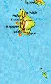
For a general map of the Ionian islands, click here!. For a map of the Kithira island area, click here.
To go back to the Ionian islands main page, click here!
KITHIRA or CYTHERA
 |
Modern Greek K�THIRA, southernmost and easternmost of the Ionian Islands (pop 3,469), off the southern Peloponnesus. A continuation of the Taiyetos mountain range, the island has a mountainous interior, rising to 1,663 feet (507 m). The capital, K�thira (or Kh�ra), is on the southern coast. |
Exportation of murex, a purple dye obtained from a species of mollusk, was responsible for the island's ancient name, Porphyrusa (Greek porphyra, "purple"); but a lack of natural harbours precluded the island from gaining political importance. Cythera was also noted in ancient times for its local cult of Aphrodite. As a Spartan outpost the island was subdued (424 BC) by Athens during the Peloponnesian War. After the Fourth Crusade (1204) it was subjected to
frequent incursions; in 1537 the island's inhabitants were sold into slavery. In 1717 Venice took over the island, renaming it Cerigo. Thereafter its history is largely that of the Ionian Islands. The island produces small amounts of wheat, barley, grapes, olives, and olive oil. There are daily flights to Athens from the island.
Transport
By air from Athens and by boat from Pireaus and various ports of southern Peloponnisos.
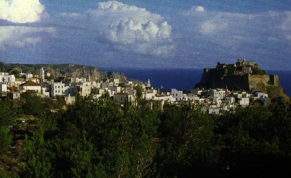
Kithira Town
This very small capital of the island (just 600 people) is very interesting in its traditionally narrow streets and old churches. The Venetian fort has existed for many centuries and houses many worth while churches. There is an Archaeological museum with many interesting loacl findings. A number of places offer culinary delights with spectacular views.
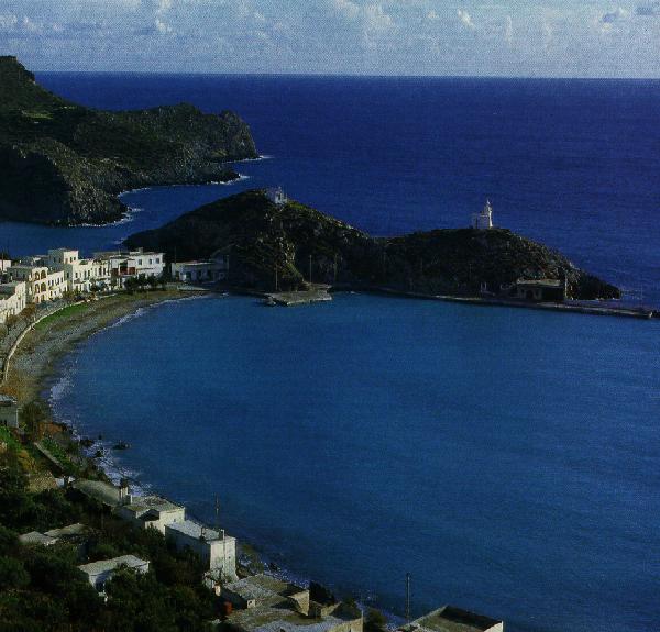
Kapsali (3km)
The second port of the island with beautiful sea views. Nearby is the monastery (1592) of St John, the author of Revelations before he went to Patmos. The village boasts some very nice tavernas and night spots.
Livadi (4km)
The village has many interesting English manor houses and an interesting 12th c. church of St Andreas as well as the nearby monastery of St. Ellessa.
Mylopotamos
Probably the most beautiful village of the island, of middle-age historical roots. A venetian casle is nearby as well as the cave of St Sophia.
Potamos (19km)
The largest village of the island with an interesting square and many pine trees and many wort while churches.
Aghia Pelagia (26km)
This is the main port of the island with a lot of tourist interest. Nearby is the village of Diakofti with the little island of Makrykythira in front.
Karavas (27km)
A very green village with spas and many noteworthy churches to visit.
Antikythyra
This is a small rocky island south of the main Kythyra island. There are ruins of an ancient town at Potamos which is the modern capital. The island was a stonghold of pirates for many centuries and was called Cerrigoto. There are very few amenities and so it offers a real get-away-from-it-all type of tourism.
ERIKOUSA, OTHONOI AND MATHRAKIO
These are the three main islands north of Kerkyra. Unspoilt, rarely visited. Almost monastic, they each have no more than 200 people population. Their history is unknown but a cave on Othonoi is purported to be the cave of Kalypso, the Homeric Oryggia. Only basic amenities are available but excellent for those that prefer unspoilt beauty.
|