| LEFKAS |
 |
 |
This description provides information of ancient sites, seaside resorts, churches, monasteries, landscapes and small towns and villages. Additional details can be found in various books printed on Greece, such as the 'Blue Guide to Greece.' The names of places conform to the accented Greek pronounciation which would be the one a traveller would face upon a potential visit.
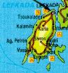
For a general map of the Ionian islands, click here!. For a map of the Leflas island area, click here.
To go back to the Ionian islands main page, click here!
LEFKAS or LEFKADA or LEUCAS
 |
Modern Greek LEVK�S, also called LEVK�DHIA, island of Megan�si nearby (117-sq-miles/303-sq-km, pop 21863). A hilly mass of limestone and bituminous shales culminating in the centre in Mt. El�ti (3,799 ft [1,158 m]). The chief town, Levk�s, lies at the northeastern corner, which in antiquity was separated by a marshy isthmus. It was formerly called Amax�khi or Santa Maura; the latter is also the Venetian name for the island. Most of the population inhabit the wooded east coast and its valleys.
|
Mycenaean remains at Nidhr� on the east coast testify to early occupation and convince some scholars that Leucas, not Ithaca, was the home of Odysseus. In the mid-7th century BC, Corinthian colonists established themselves just south of the present capital and dug a canal through the isthmus. Under Roman rule in the 2nd century BC, a stone bridge, of which there are some remains, was constructed to the main island. In 167 the Romans made Leucas a free city. During the 13th century AD the island was subject to the Despotate of Epirus, and in 1479 it was seized by the Turks. The island was alternately under Turkish and Venetian control until 1718, when it was formally ceded to Venice. After the 18th century it shared the political fortunes of the other Ionian islands under British rule. In 1864 it was restored to Greece.
The island has suffered for centuries from severe earthquakes; those of 1867 and 1948 severely damaged the capital.
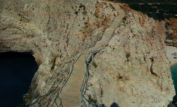
Cape Leucatas at the southwestern tip of the island has fragments of the ruined temple of Apollo Leucatas; nearby are the 200-ft white cliffs that give the island its Greek name. In antiquity they served as a trial by ordeal (the "Leucadian leap") for accused persons, survivors being picked up by boat. According to legend, Sappho, desperate with love, ended her life here. Economic activities include considerable olive-oil production but meagre cereal cultivation. The currant, introduced about 1859, has been one of the chief cash crops. Cotton, flax, tobacco, and valonia are produced, and much red wine is exported. In 1903 the isthmus was cut by a ship canal. Pop. (1981) 21,863.
Transport
By road over the new bridge from the mainland from Amfilohia via Vonitsa. By air from Athens. Many local boat connections.
Leukada town
A very interesting, well heeled town with many museums and sights. The canal at the promenade was built to protect the town from pirates. There are many very interesting churches and many museums. The island was the birthplace of many well known Greek over the years and their statues are displayed in many places over the town and especially at Bosketo park. Ancient Leukas town is about 3km away and it has been calculated that it must have been one of the largest ancient greek towns. The famous Alabaster Cave is only 1.5km from the town and is well worth visiting to see the spectacular alabaster-like stalactites and stalagmites and other interesting displays.
Frynio
The monastery of Panagia Faneromeni was first built in 1634 and rebult later. It has excellent views to the sea.
Lygia (6km)
The second largest fishing town in western Greece. Nearby is the Paradise river basin with the aptly called "love's nest" hills.
Nikiana (10km)
Well developed tourist village with an interesting church and fantastic sunsets over Meganisi. The monastery of St George is nearby.
Nydri (17km)
The most developed of the island's resorts. With the mountain behind you, the islands of Skoprios, owned by the Onassis family, Skorpidi owned by Livanos family and Madouri and the green peninsula of Santa Kyriaki will take your breath away. Nearby you will also find the Dimosari gorge and Ronies waterfalls. There are also interesting prehistoric and protoelladic tombs and other ruins.
Prigiponisa (Pincess's islands)
They are all opposite Nydri and well worth visiting if you enjoy unspoilt beaches and spectacular nature. The largest is Meganisi and they all offer many pleasures.
Poros (27km)
A small village with beautiful beaches far from the crowds. There is a venetian castle and a 17th c church.
Sivota (33km)
A spectacular fishing village with traditional beauty at the heart of a bay. Well worth keeping your hunger for one of the lovely fishing tavernas. Nearby is Marantohori with a church dating from the late 15th c.
Vasiliki (38km)
Tourist, green village on a hill famous for wind-surfing. Boat connections to Cephallonia and Ithaki. There are ruins of a temple to Applo and Pelasgic walls.
Ag. Nikitas (14km)
Traditional, beautiful fishing village, with unforgettable beauty. As a result it has been developed very well lately. It boasts multi-coloured houses wityh tradional architecture and almost looks unreal. The beach is almost magical with its sand and massive rock formations. Close by is the massive beach Kathisma. By boat you can visit Athani and Egremnous which are spectacular vertical cliffs.
Porto Katsiki
This is a beach which must not be missed - wild and rough with steep rocks, it boasts a fantastic green-blue crystal clear sea. Amazing scenery. Finally at the southernmost tip of the island you will find the cape of Leukatas where, according to legend, Sapfo jumped to her death after falling in love with Faonas.
Karya (14km)
Mountain village which is reached along the road next to the highest peak of the island at 1158m. Interesting traditional architecture and weaving.
|